Menorca: route maps
Menorca: route maps
I don’t normally carry the technology for uploading my route maps from my GPS to my blog, so here they are. I stayed mainly in the south of the island because that is where most of the rideable roads are.

Intended as a 30km warm-up ride, it turned into a 71km exploration of the south of the island.

77km taking me to two coastal holiday villages…..thankfully one of them had some services open!
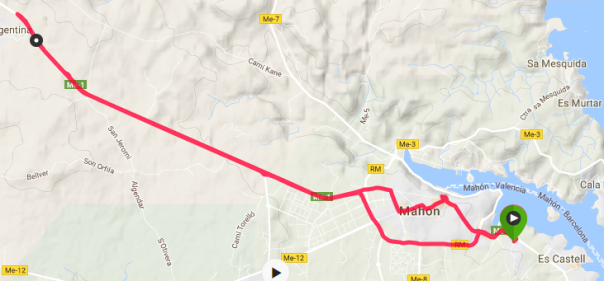
25km, my attempt to cycle the length of the island to Ciutadella was foiled by the ferocity of the weather.

91km, in search of beaches and bays that lie several kms off the main roads. Everywhere is closed up for winter.

72km, a final route that included paeleo-Christian basilica and 19th century fort.
Posted on January 22, 2017, in Cycling Menorca and tagged cycling, maps, Menorca, routes. Bookmark the permalink. 3 Comments.

It has been a pleasure to read your messages from Menorca. I may send them on to a daughter who was there over the New Year. She was working and doesn’t know what she missed!
LikeLiked by 1 person
It was a week of adventure ……frequently testing my spirit of adventure!
LikeLike
Excellent weblog right here! Additionally your site rather a lot up fast! What host are you using? Can I am getting your affiliate hyperlink for your host? I wish my site loaded up as fast as yours lol
LikeLike